Mif
Advertisement
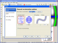
GeoVisu v.5.0.1
GeoVisu is a program that displays georeferenced data (images, graphics) and downloads data recorded by some GPS devices. GeoVisu has a 'Moving map' navigation function, which can be used with any NMEA 0183 compatible or Garmin USB GPS device.
Advertisement
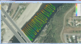
AgDataViewer v.5 5
ADV comes with tools that allow you to create polygons, lines and points in fields from the comfort of your office.
SISXplorer v.1 1
As mobile phones using the Symbian 60 version 3 OS are so common, we also come across many software packages which includes themes, software, games, etc. These packages are available in the form of .sisx files.
Monitor Asset Manager v.2.60.0.972
Monitor Asset Manager is a Plug and Play monitor information utility that works under all 32-bit and 64-bit versions of Windows.
SISContents v.1 7
SISContents is a tool that allows you to unpack, edit and sign Symbian 9 SIS packages (Nokia S60 3rd, 5th Edition and Sony Ericsson UIQ 3.x platforms are supported).
GPS Pathfinder Office v.5 20
Powerful and easy to use GPS data processing software The GPS Pathfinder Office software is a powerful and easy-to-use software package of powerful GNSS postprocessing tools, incorporating the new Trimble DeltaPhase differential correction techno
InterpOSe for Digimap From Dotted Eyes v.4.6.0.128
InterpOSe for Digimap is designed to process the data delivered as part of EDINA's new OS MasterMap service for Academic Organisations within the UK.
Eye4Software Hydromagic v.7.0.15.929
Hydrographic Survey Software for Windows, Load topographic or nautical maps, create singlebeam soundings, generate DTM's (Digital Terrain Models), generate depth contours, generate cross-sections, volume calculations and more.
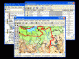
GIS ObjectLand v.2. 6. 2003
GIS ObjectLand is a universal Geographic Information System for Windows. Key features: - creation of vector-raster maps with arbitrary structure of layers and feature types; - creation of themes. Theme is a user presentation of a map; - control of
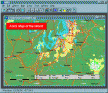
AGIS for Windows v.2002
AGIS for Windows is a mapping and simple GIS shareware package. Plot your own geographic data on the map of the world provided without the high cost and steep learning curve usually associated with this kind of software.
Swordfish v.3.0-11
Cross-platform Translation Editor. Swordfish is an advanced software based on XLIFF 1.2 open standard and designed for demanding professional translators.Swordfish features include filters for multiple document formats, full support for TMX standard,